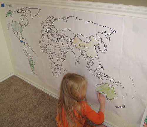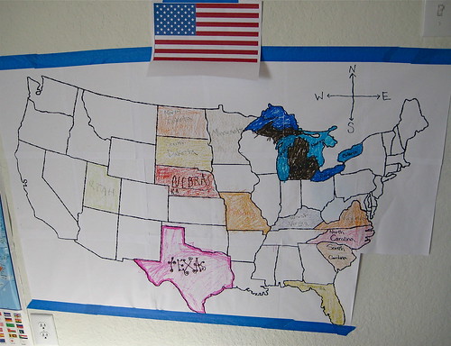
We love to color at our house. So when we were learning about where things are, it just made sense to make a wall map to color. We've made a United Staes Wall Map and World Wall Map.

Want to make one too?
I started by deciding how much room I had on my wall. For my world map, I had a long space but only enough height for three pieces of paper. When I was making my U.S. map, width was the limiting factor. I only had room for 6 paper widths which made for a map 3 paper heights high as well.
Then in my printer menu I used the option for scaling the image. I played around with this in my printer preview until it was the size I needed for my wall. The scaling for a wall map will likely be between 500% and 900%. For my world map, I scaled the image to 800% and printed out pages 1-24 making a 3x8 paper map.
Around each printed paper there is a white border. Using my glue stick, I glued the pages together; overlapping so that the map line from one page matched the next.
After glueing the pages together, I used my black sharpie to trace the map line of the page underneath onto the border of the page on top so that the map lines are continuous.
We've been using our world map with Confessions of a Homeschooler's Expedition Earth Animals.
What will you make a map of?


1 comment:
We're working on South America-love this idea!
Post a Comment